What to Explore
Superstructure
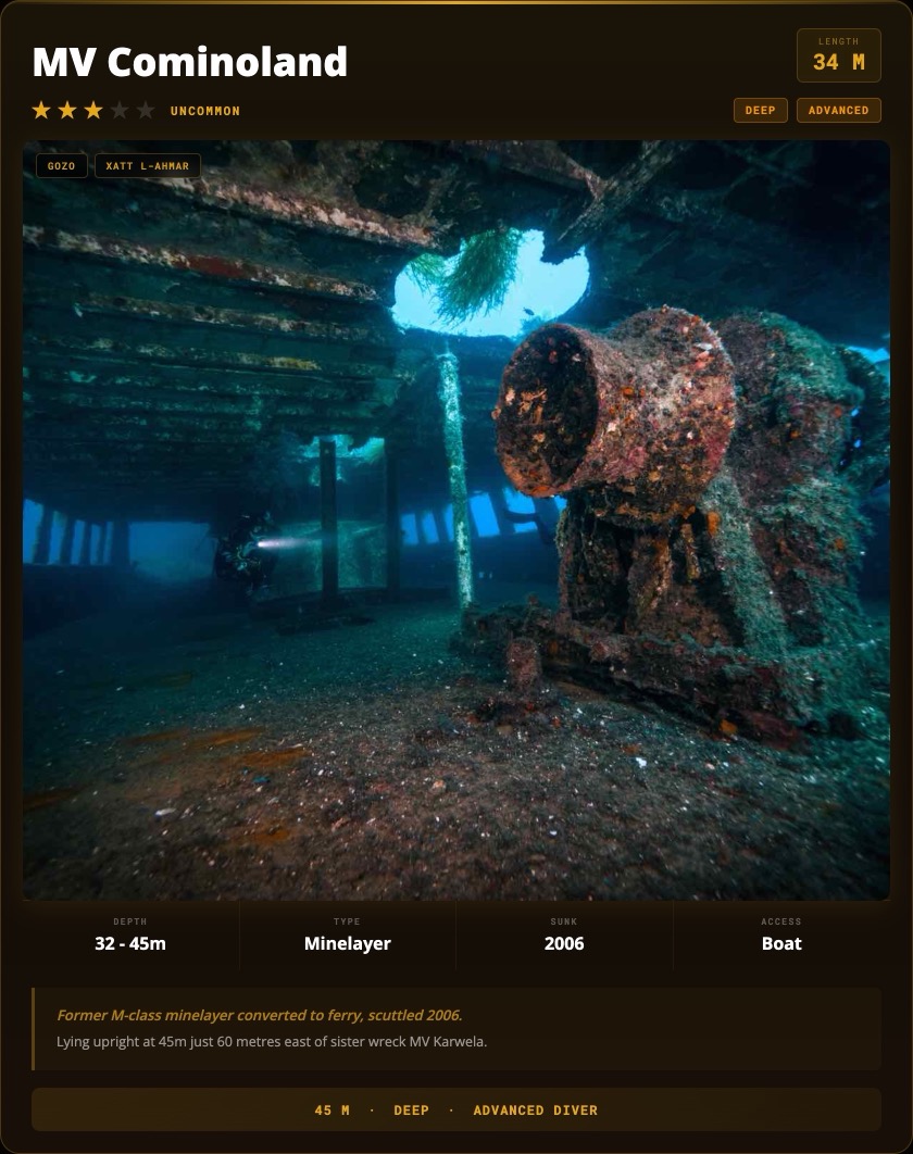
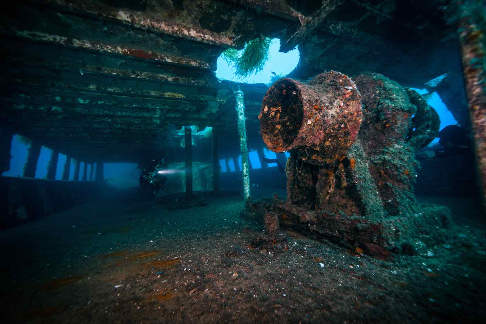
The superstructure of the Cominoland begins at 32 metres, its stripped hull now completely covered in encrusting life. With no paint layer to influence substrate chemistry, colonisation has followed a different trajectory than Karwela. Dense sponge coverage and sea fans blanket every surface. The contrast is immediately apparent when both wrecks are dived on the same day.
Penetration Decks
Two decks are open for penetration, with all access points cut before scuttling to ensure safe passage. The openings are generous, natural light reaches much of the interior on clear days, and the layout does not require a complex route. A primary torch is required for corners and the lower passages. Good buoyancy control is essential to avoid disturbing the silt layer.
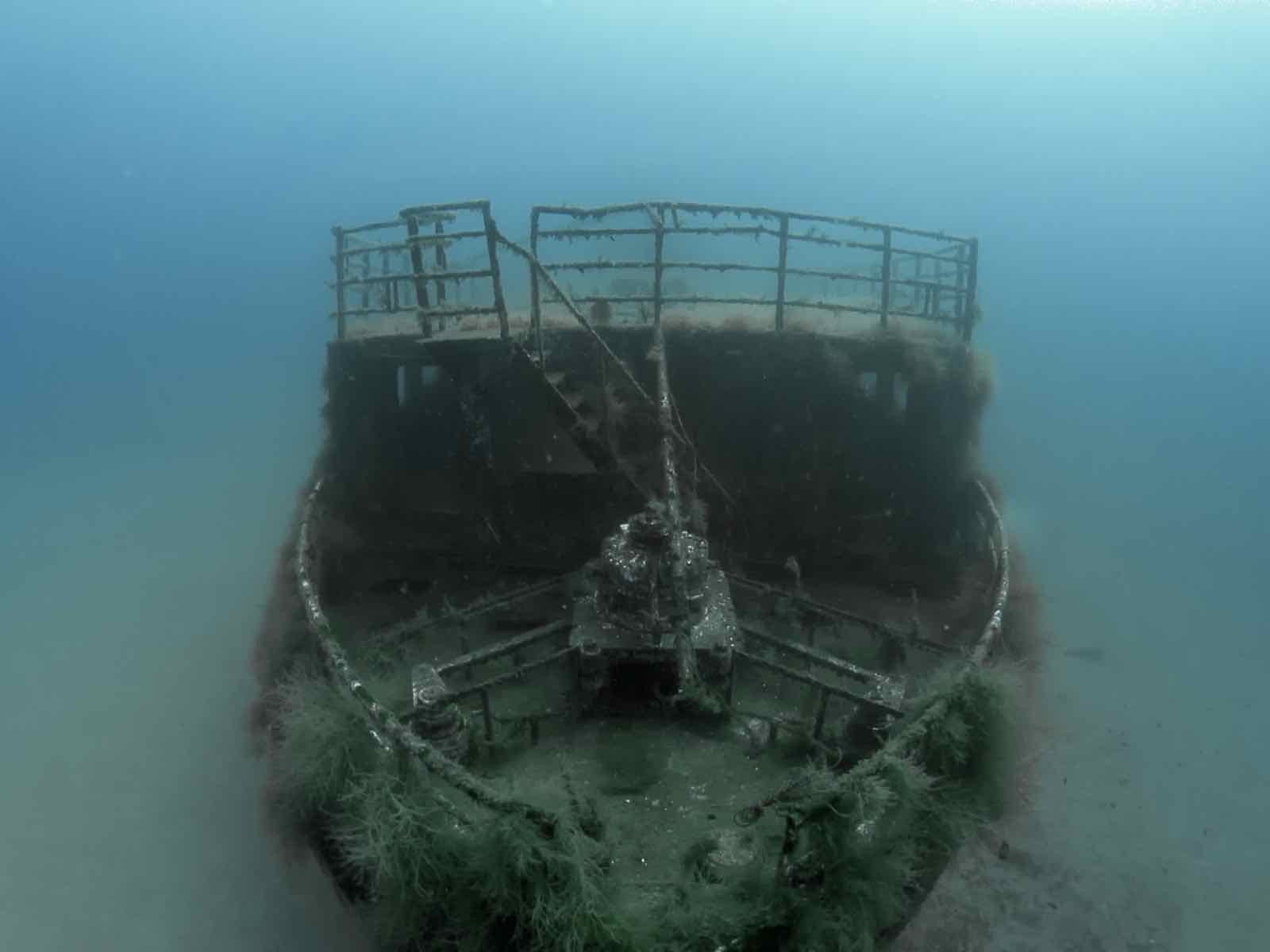
Bow Section
The bow descends to 39 metres with the keel reaching the sandy seabed at 45 metres. The original M-class minelayer hull form is still discernible in the bow shape, giving the wreck its distinctive compact and slightly angular profile. Large grouper patrol the area regularly. Gas planning must account for time at depth before the ascent to the main deck.
The Karwela Crossing
At only 60 metres apart, the Cominoland and Karwela can be linked in a single dive with careful planning. Transit across the sandy seabed at around 40 metres. The size difference is striking: Karwela is 50 metres, Cominoland 34 metres. The paint-versus-stripped-hull comparison makes this a genuinely instructive dive as much as a recreational one.